|
|
|
|
 |
2005 Pacific Crest Trail:
|
|
 |
|
 The Chronicles of Goodfoot and Toaster:
(aka Samantha and Gabriel)
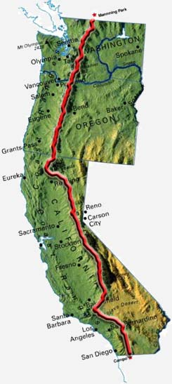
On April 17, 2005 my partner and I set out from the Mexican border for a six-month backpacking expedition
to reach Canada by way of the Pacific Crest Trail. The PCT travels over 2650 miles through California,
Oregon and Washington. It traverses a wide variety of landscapes ranging from the waterless deserts of
southern California to glacier-capped peaks of the Pacific Northwest. This trip took years to plan, and
was more eventful and inspiring then we ever could have imagined. Due to injury and illness, we did admittedly
have to skip a few notable sections of the trail this season. Yet by the end, we completed over 2400 miles
and gained a much greater respect for nature (as well as our sore feet).
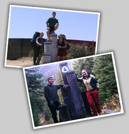
During the course of the adventure, we logged hundreds of journals, took thousands
of pictures and even captured a few short movies. Now that the
trip is at an end, I have taken some time to compile everything onto this site and plan to update it from time to
time. Please have a look around and enjoy yourself. The links below will lead you to the individual sections of
the site. Make sure to click on the photo icons to display the images at a higher resolution. Also, we would
like to thank everyone who have and continue to support us in our endeavors. Please feel free to drop us a line at
trailb@gmail.com to let us know what you think...
Here's a GPS map of all the logs...
-- Goodfoot and Toaster
|
|
|
|
|
 |
|
|
|